
BionicSense
Next-Gen Perception & Multi-Sensor Fusion for Autonomous Aerial Intelligence
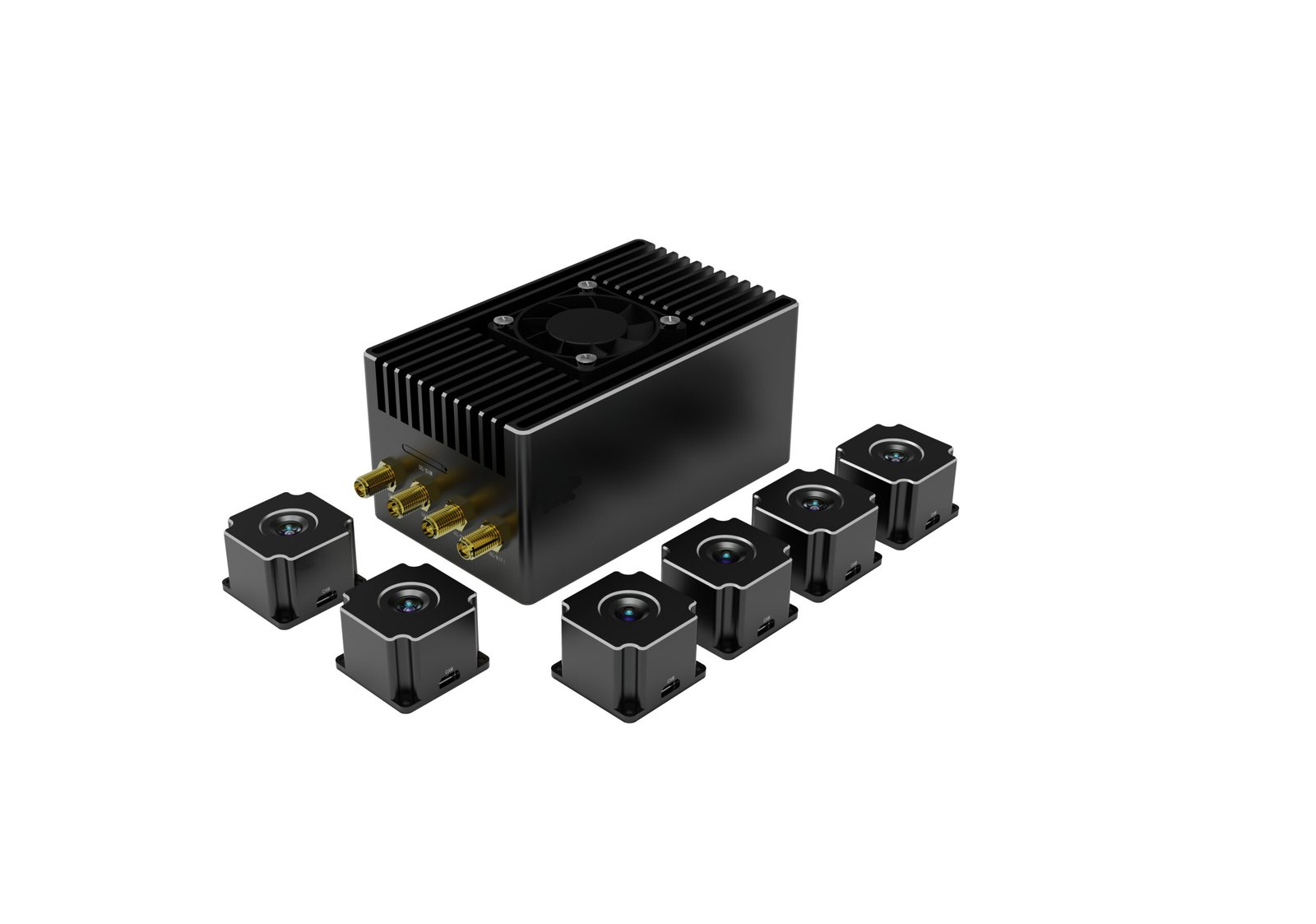
BionicSense is a visual self-driving system developed independently by IntelliFleye. Using powerful edge computing, it builds a real-time 3D map of the surroundings, plans the flight path and makes decisions around obstacles, so drones can fly autonomously even where GNSS is not available.
Triple
Redundant IMU, barometer and compass
±5 cm
Positioning accuracy
386 g
Total system weight
6
Maximum number of visual sensors
Key Capabilities



General CAPABILITIES


Frequently Asked Questions (FAQ)
What is BionicSense, and how does it work with BionicNavi-100?
BionicSense is an advanced multi-sensor perception and edge-computing payload that gives autonomous systems real-time situational awareness. While BionicNavi-100 handles core positioning, GNSS-denied navigation, and guidance, BionicSense acts as the "eyes and ears," feeding fused optical, radar, and LiDAR data directly into the navigation pipeline for seamless obstacle avoidance and hazard detection.
Does BionicSense require an external companion computer?
No. BionicSense features a dedicated onboard edge AI neural accelerator. It processes heavy multi-spectral, optical, and radar data streams locally on the device, eliminating the need for an external heavy companion computer and saving valuable payload weight and power.
Which flight controllers and software environments are supported?
BionicSense is designed for smooth integration into existing autonomous ecosystems. It natively supports:
1. Protocols: MAVLink (v1.0/v2.0) and custom binary protocols via high-speed UART or Ethernet.
2. Frameworks: Full native support for ROS and ROS2.
3. Autopilots: Compatible with standard open-source autopilots like PX4 and ArduPilot.
How does BionicSense perform in GNSS-denied, dark, or foggy environments?
By using hardware-level multi-sensor fusion, BionicSense automatically balances inputs across its available sensors. When optical or GPS signals fail, it seamlessly relies on its micro-Doppler radar, thermal IR, and visual-inertial data to maintain continuous spatial tracking, obstacle detection, and safe flight paths through smoke, dust, or complete darkness.