
Tunnel inspection
with out GPS
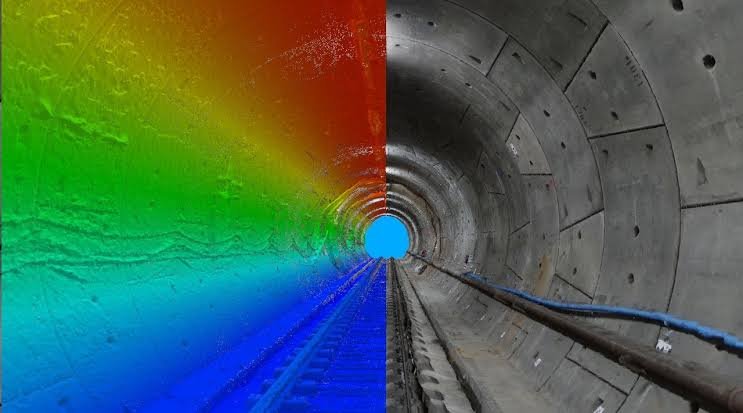
Inside a tunnel there is no satellite signal. IntelliFleye drones build a real-time 3D map and fly the length of the tunnel on their own, giving engineers a close view of hazardous, hard-to-reach areas.
Why Its Hard
Tunnels Are Difficult To Inspect With A Standard Drone
No GPS Signal
Inside a tunnel there are no satellites, so a GPS-dependent drone cannot hold its position.
Hazardous, Hard-to-Reach Areas
Long tunnels are slow and risky for people to inspect on foot.
Confined Space With Obstacles
Walls, cables and equipment leave little room, so the drone has to see and avoid obstacles by itself.
How IntelliFleye Helps
Autonomous Flight Where GNSS Is Missing
Flies Without GNSS
Cameras and specialised sensors give accurate positioning and a detailed 3D map, with no satellite signal needed.
Plans The Path, Avoids Obstacles
BionicSense plans the flight path and avoids piers, cables and other obstacles in real time.
Mission Planning On The Ground
Operators set waypoints and plan flight trajectories in the ground control station before takeoff.
Where It Works
Built For Tunnels And Underground Spaces
Highway Tunnels
Fly the entire length of a tunnel for an in-depth inspection.
Underground Tunnels
Accurate 3D mapping of underground terrain with no GNSS.
Mines and Caves
Positioning where GPS is completely unavailable.
A close view of hazardous, hard-to-reach areas.
How It Works
From Plan To Result In Three Steps
Plan
Set waypoints and the flight trajectory in the ground control station.
Fly
The drone follows the route on its own and avoids obstacles.
Review
Engineers review the inspection footage and plan maintenance.
Tunnel inspection video
Which product fits
Choose How You Want To Fly
Complete System
BionicSense
Visual self-driving system with 3D mapping, path planning and obstacle avoidance. Triple-redundant IMU, barometer and compass.
Navigation Sensor
BionicNavi BN-100
Adds accurate position data to your own drone, with and without GPS. 265 g, works with PX4 and ArduPilot.
Frequently asked questions (FAQ)
Can a drone inspect a tunnel without GPS?
Yes. BionicSense uses cameras and specialised sensors to build a 3D map and fly autonomously where GNSS is not available, such as inside a tunnel.
How far can the drone fly inside a tunnel?
Drones with the BionicSense solution can fly the entire length of a tunnel for an in-depth inspection.
Do I need to buy a drone from IntelliFleye?
No. If your drone has a PX4 or ArduPilot flight controller, BionicNavi BN-100 can give it accurate position data. IntelliFleye also offers the S400 series drones.
How do I get a quote?
Use the Talk to Sales button or email Business@intellifleye.com and tell us about your tunnel.
Tell us about your tunnel
Tell us about your site and your mission. Our team will recommend the right model.