
PRESS RELEASE · 17 November 2026
IntelliFleye Introduces BionicNavi, a Visual Navigation Sensor for PX4 and ArduPilot Drones Without GPS
Compact onboard sensor delivers position and velocity to the flight controller with no companion computer and no pre-built map.
IntelliFleye today introduced BionicNavi, a visual navigation sensor that gives drones, unmanned vehicles, unmanned ships and robots reliable positioning with or without GPS. It is designed for places where satellite signals fail, such as tunnels, mines, substations and indoor sites.
BionicNavi uses visual-inertial navigation, not LiDAR SLAM or radar. It fuses a visual odometry sensor with the autopilot's IMU in the flight controller's Extended Kalman Filter (EKF2 on PX4, EKF3 on ArduPilot). Positioning needs no pre-built map. Processing happens on the unit, so no companion computer is required, and position and velocity data go straight to the flight controller.
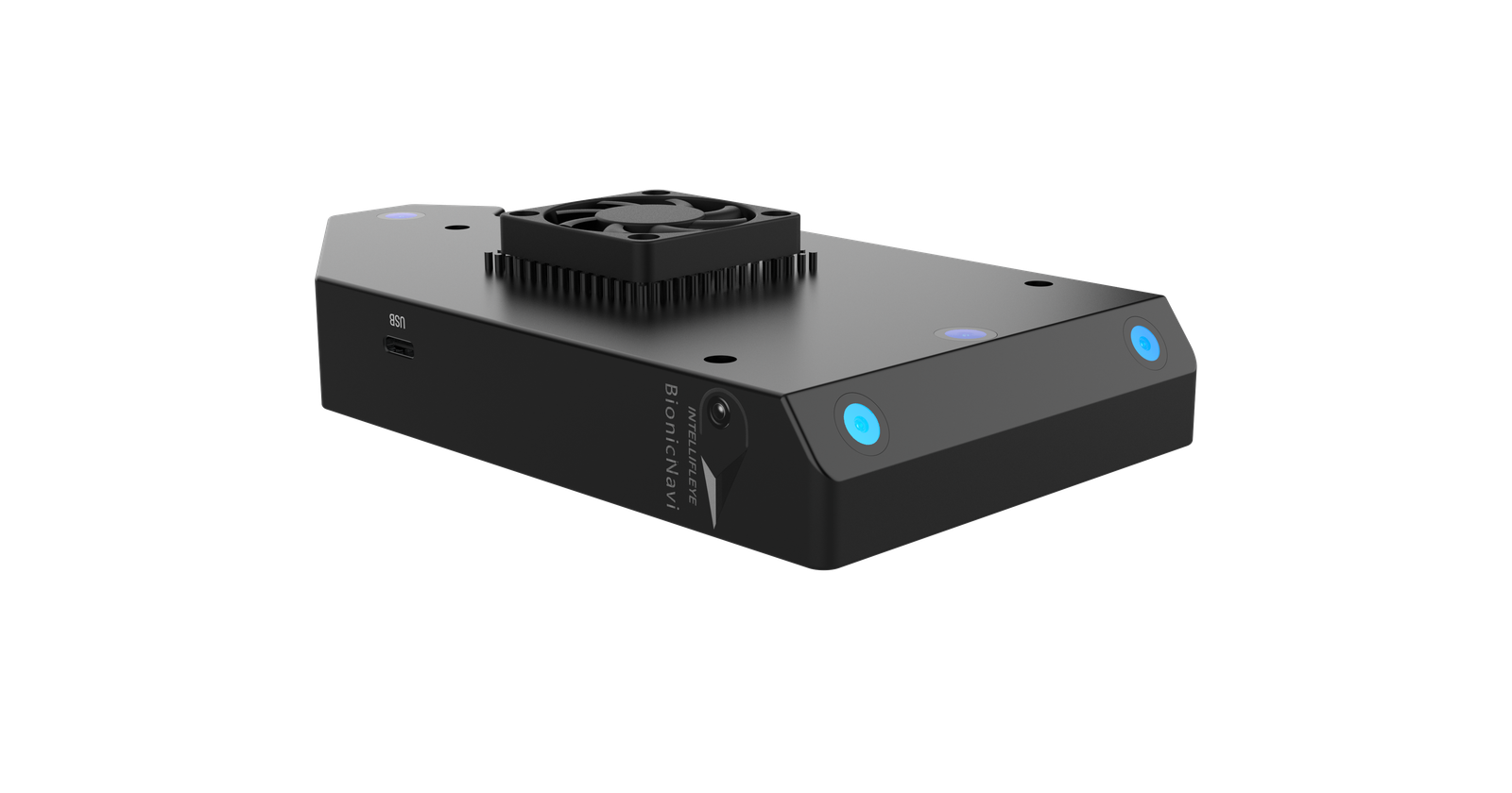
"Drones often have to work where GPS can't reach, such as tunnels, mines and substations. BionicNavi lets them keep flying accurately there, with no companion computer and no pre-built map." – David, Product Manager, IntelliFleye
Key facts
• Accuracy: ±10 cm horizontal and vertical in visual mode with good image quality and no satellite signal. Satellite-inertial mode with a good signal: ±150 cm horizontal, ±100 cm vertical.
• Size and weight: 265 g including the external GNSS antenna; 169 × 130 × 34.7 mm.
• Power: 10 W rated, 6–19 V input, with overcurrent protection.
• Update rate: odometry up to about 49 Hz, observed in field logs.
• Compatibility: PX4 v1.16.2 or later and ArduPilot/ArduCopter v4.6.3 or later. Tested on Pixhawk V6X; intended for Pixhawk-series autopilots.
• Interface: UART at 921600 baud; MAVLink v1.0/v2.0 or IntelliFleye's binary protocol. An SDK is available for custom development.
Where it is used
BionicNavi is aimed at inspection in strong-interference areas such as transformers and substations, search and rescue in tunnels, mines and caves, and mapping of tunnels, bridges and underground spaces, where GPS is unavailable or lighting is poor.
About IntelliFleye
Founded in 2017, IntelliFleye develops autonomous inspection drones and navigation technology for environments where GPS is unreliable, including bridges, tunnels, transformers and warehouses. Its products include the BionicNavi navigation sensor, BionicSense and the S400 series drones.
Media contact
David, Product Manager
Email: Business@intellifleye.com
Office 302, Sunshine City, Taiping, Kunming, Yunnan Province, China